By Islam El Shazly
Abu Abdullah Muhammad ibn Muhammad ibn Abdullah Al-Idrisi, also known as AsShareef Al-Idrisi, was one of the greatest geographers and cartographers in the 12th century CE, if not the top geographer of his time, one whose capacity at visualising and putting into words what the world looked like was not matched by any contemporary mind in Europe where he resided at the court of King Roger II of Sicily. His book, Nuzhat al-Mushtaq, would live on inspiring countless future explorers from Ibn Battuta to Marco Polo.
And yet his life was not chronicled in depth by any Muslim historians, for reasons that can be debated, for which this is not the platform. One author, Muhammad Abdul-Ghani Hassan, broke the trend, and, in 1971 published a book about the life and times of Al-Idrisi in his book AsShareef Al-Idrisi: The most famous of Muslim and Arab Explorers. A lot of this post will be based on that book insha’Allah.
Al-Idrisi was born in Ceuta in Morocco — occupied by Spain since 1415 CE — in 493 AH (1100 CE), and while not much is known about his early childhood, nor about who he studied under, this much is known, much of his early life was spent travelling through North Africa and Andalucía and seems to have acquired detailed information on both regions. There’s also some evidence that he visited Anatolia when he was barely 16. He is known to have studied in Córdoba, one of the greatest centres of cultural and Islamic learning at the time.
The roster of places he visited is as impressive as his body of literature; Egypt was one of his stops in the Islamic Orient, and in the west it included Portugal, The Pyrenees, the French Atlantic coast, Hungary, and Jórvík also known as York, in England. [Source: Wikipedia]
In 1138 CE he received an invitation to the court of King Roger II of Sicily, by none other than the king himself. There he would be treated to a hospitality rarely seen at a royal court, where the king venerated him to extents never before heard of. It is said that he allowed him to ride his mule all the way into the palace in Palermo and when he arrived he would seat him to his side in the throne room or counsel.
It’s worth mentioning that the Norman kings of Sicily were an anomaly within European Christian Kingdoms, in that they followed in the footsteps of the Muslim rulers, to the extent that at one point Roger II himself was accused of converting to Islam!
Tabula Rogeriana
Al-Idrisi was commissioned by Roger II — who was no stranger to philosophy, mathematics, and forays into unusual inventions — to construct a map of the known world. Using 400,000 Drachmas worth of silver (the equivalent of 1,720 kg of silver!) he then created multiple spheres, mounting and amalgamating one on the other, then sculpting and engraving it into a three dimensional map of the world. The map only used a third of the amount of silver, ultimately weighing in around 450 lb, the rest were given to Al-Idrisi as a gift.
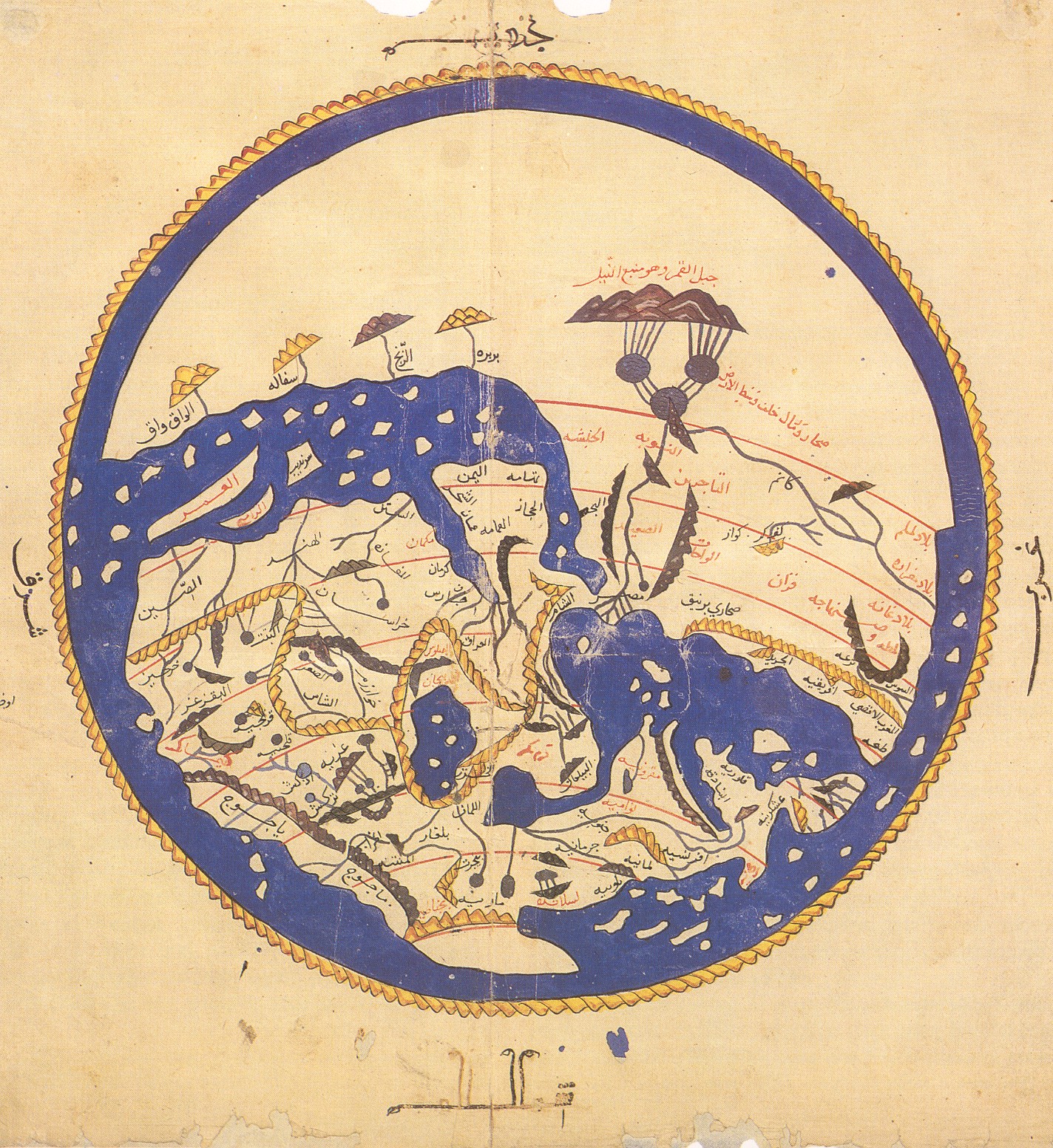
Al-Idrisi’s world map, presented upside down in his book with South on top. Wikipedia Commons
Over a period of 15 years, Al-Idrisi would incorporate knowledge of Africa, the Indian Ocean, and the Far East gathered by Islamic Merchants and explorers along with Islamic records and maps, and interviews of Norman sailors and voyagers conducted both by him and by the King. They dispatched draftsmen, and travellers to the corners of the known world to gather first hand information and relay it in detail to be copied in to the great tome on geography. In 1154, just a few weeks before the king died, al-Idrisi’s book was finally complete. Written in Arabic and Latin and accompanied by maps, it presented the world as a sphere. It calculated the circumference to be 37,000 kilometers (22,900 mi)—an error of less than 10 percent. It followed the classical Greek tradition, dividing the world into seven climate zones supported by 70 longitudinal section maps which, when put together, made a rectangular map of the known world. [Source: Saudi Aramco]
Sadly, the silver map appears to have been destroyed during civil unrest shortly afterwards, in 1160.
A Diversion for the Man Longing to Travel to Far-Off Places.
In his book, The History of the Moorish Empire in Europe, Samuel Parsons Scott (8 July 1846 – 30 May 1929), known as S.P. Scott, an American attorney, banker, and scholar, wrote about the immensity of the undertaking of Al-Idrisi and its consequence, legacy, and bearing on cartography and geography:
“The compilation of Edrisi marks an era in the history of science. Not only is its historical information most interesting and valuable, but its descriptions of many parts of the earth are still authoritative. For three centuries geographers copied his maps without alteration. The relative position of the lakes which form the Nile, as delineated in his work, does not differ greatly from that established by Baker and Stanley more than seven hundred years afterwards, and their number is the same. The mechanical genius of the author was not inferior to his erudition. The celestial and terrestrial planisphere of silver which he constructed for his royal patron was nearly six feet in diameter, and weighed four hundred and fifty pounds; upon the one side the zodiac and the constellations, upon the other-divided for convenience into segments-the bodies of land and water, with the respective situations of the various countries, were engraved.”
Only ten manuscript copies of the Book of Roger currently survive, five of which have complete text and eight of which have maps. Two are in the Bibliothèque nationale de France, including the oldest, dated to about 1325. Another copy, made in Cairo in 1553, is in the Bodleian Library in Oxford, acquired in 1692. The most complete manuscript, which includes the world map and all seventy sectional maps, is kept in Istanbul. [Source: Wikipedia]
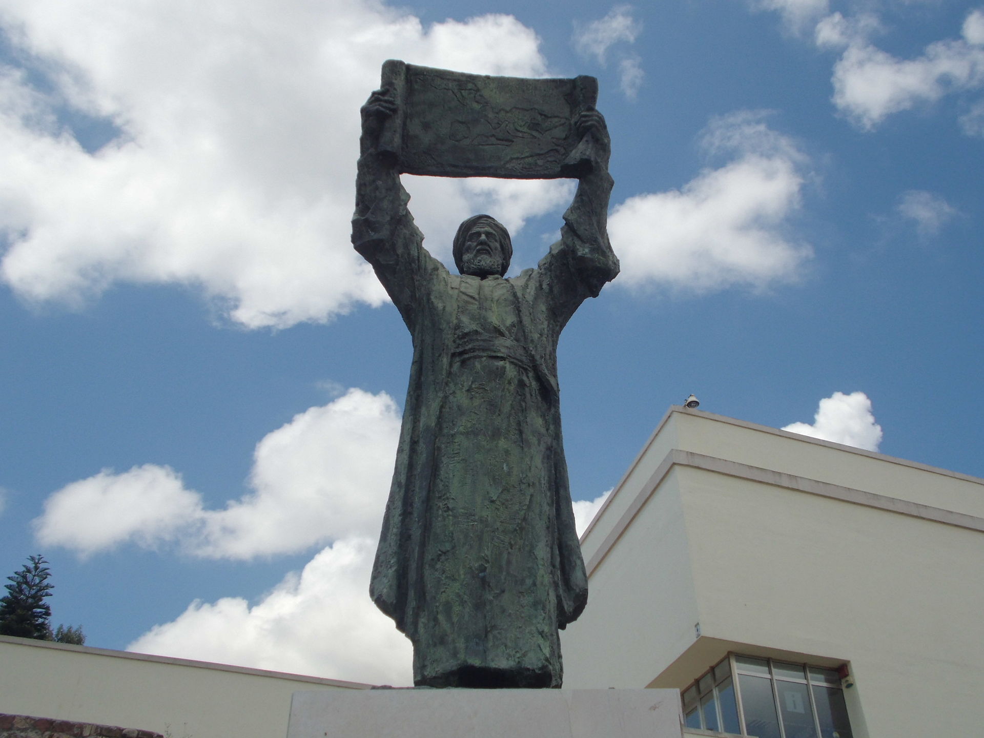
Statue of Al-Idrisi, under the stronghold of the Majorcan in Ceuta. Wikimedia Commons.
Although he excelled in geography, Al-Idrisi, this Muslim scholar, was also a botanist who dabbled in pharmacology and medicine, he left behind a compendium about plants with a detailed explanation of their Syriac, Greek, Latin, Berber, and Arabic names and characteristics; with two other books credited to him, one in pharmacology and another in medicine.
His legacy in the world of geography and exploration remain to this day, one could even say that explorers like Christopher Columbus and Vasco Da Gama wouldn’t have accomplished much of their discoveries had they not had a solid foundation in the works of Al-Idrisi (رحمه الله).
For more about Al-Idrisi you can visit:
Mapping Arabia, an article published by Saudi Aramco.


