From the moment the mighty river enters Egypt, it travels approximately 1,000 miles / 1,609 kilometres till it reaches its final destination, the Mediterranean. Without the Nile, there would not be Egypt, the Pyramids, Karnak, or any of the massive monuments that we see today. Egypt would have been just a part of the great Sahara.
In ancient times, Egypt was mostly ruled from the south, specifically from what we now call Luxor. Sadly the importance of Upper Egypt waned through millennia, and power shifted from the South all the way to the Delta and Alexandria, to finally settle in Cairo. That is the main reason for the wealth of archaeological sites and finds in the south of Egypt and along the Nile Valley.
Life hasn’t changed much here, farmers still farm the same way their ancestors did, they still use the same names for the same tools, villages have had the same names for hundreds of years.
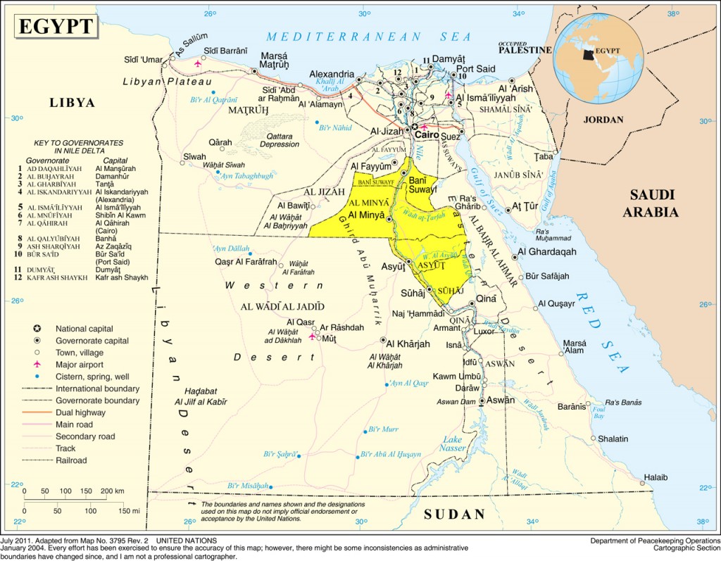
Due to the size and number of governorates along the Nile Valley, this guide is going to be split into three parts: 1) Middle Egypt; 2) Qena and Luxor; 3) Aswan and Nubia.
Bani Sueif
128km south of Cairo is Bani Sueif, mostly farmlands, there’s not much here in terms of sites, at least not in the same capacity as you venture further south up the Nile.
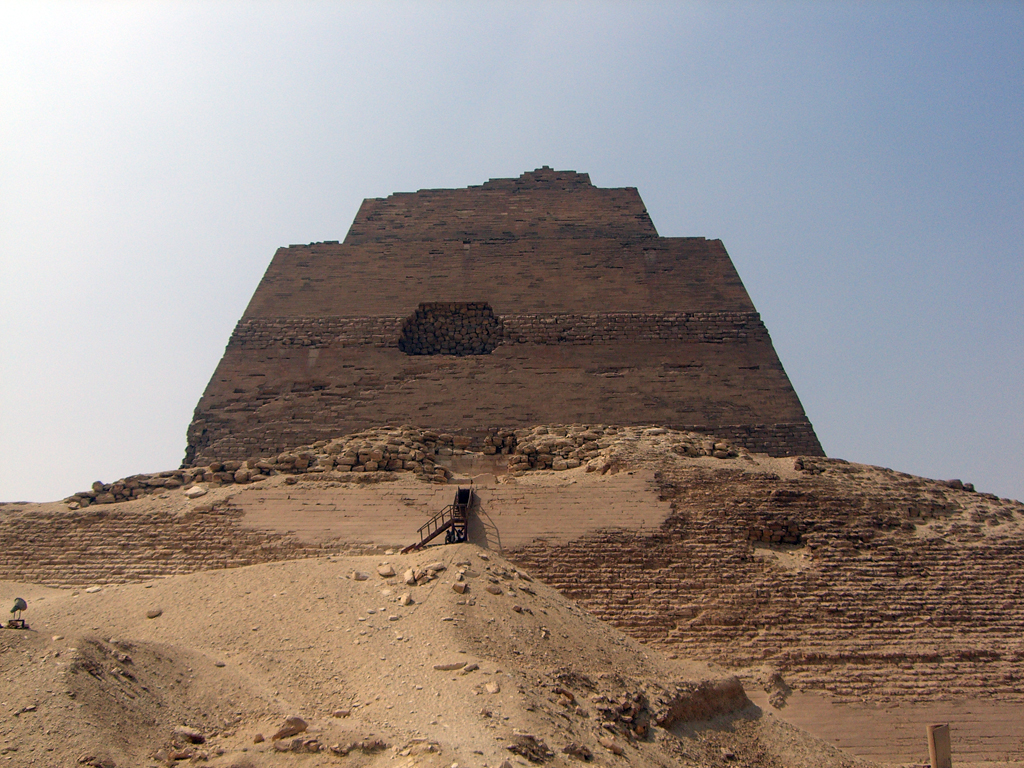
The most important site in Bani Sueif is the Pyramid of Maidum, thought to have been originally built for Huni, the last pharaoh of the Third Dynasty. It was completed and probably usurped by his successor, Sneferu, who also turned it from a step pyramid to a true pyramid by filling in the steps with limestone encasing. Also known as “the collapsed pyramid“, the outer layers of the casing began to collapse, leaving the exposed core showing. In its ruined state it stands at 65 metres. Source.
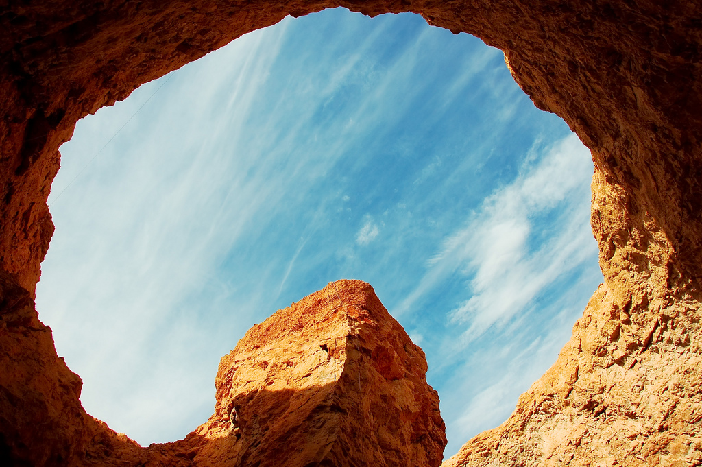
Bani Sueif is also home to one of Egypt’s best kept secrets, The Sannur Cave Protectorate. 200km from Cairo, the protected area contains the actual Sannur Cave – also known as Wadi Sannur, and extends for 12km2. Wadi Sannur is a rare type of cave formed by roofing over of a giant surface gour at its spillover point. The gour was formed by a large thermal spring (Source). Its formation dates back to the middle Eocene period about 60 million years. It is 15m wide, 15m deep, and it extends for 700m.
Minya
The Bride of Upper Egypt, is about 245km south of Egypt, it was the centre of the Cotton industry in the early 20th century, as evident from the elegant mansions and villas built by Italian architects for Egyptian and Greek cotton moguls from the early 1900’s.
Minya has a great wealth of important archaeological sites. Its remarkable history, including Ancient Egyptian, Hellenistic, Roman and Arab periods, has not yet received the full attention of scholars.
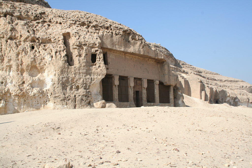
The first site lies 10km north of Minya are the Frazer Tombs, which date back to the 5th and 6th dynasties. These tombs are hewn into the cliff to the east of the Nile; they are rarely visited, so you can enjoy a leisurely exploration. A little further north is the village of Tihna Al-Jabal that houses the mud brick ruins of pharaonic town of Dehenet, it has two unfinished rock-cut temples dedicated to Amun and Sobek. Close by is the Monestary of the Virgin built by Empress Helena – mother of Byzantine Empror Constantine – it is rock-hewn and it was built in 328 CE.
The Tombs of Bani Hassan, Speos Artemidos, and Antinopolis
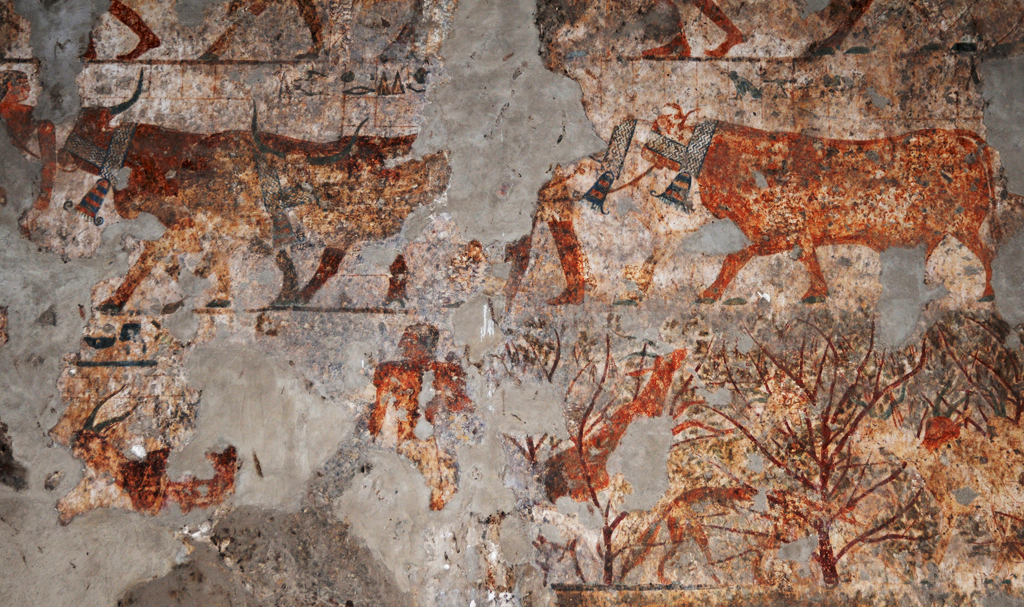
About 20km south of the city of Minya, the barren cliffs on the east bank of the Nile host the rock tombs of Bani Hassan, named after an Arab tribe that once settled there. There are 39 unfinished tombs with only four being shown to the public, their vivid murals shed light on the Middle Kingdom (2050-1800 BCE) and the greater independence the provincial rulers had at the time. A lot of the imagery involves a multitude of wrestling positions. The tombs available for public viewing are Tomb 2 – Amenemhet, known as Ameni, nomarch under Sesostris I; Tomb 3 – Khnumhotep II: notable for the depiction of caravans of Semitic traders; Tomb 15 – Baqet III: notable for the depiction of wrestling techniques; Tomb 17 – Khety, an 11th dynasty nomarch, son of Baqet; the most notable of which is the tomb of Khnumhotep II.
Two to three kilometres south from the tombs of Bani Hassan you will find Speos Artemidos (Grotto of Artemis), Also known as Istabl Antar (Antar Stable). There are two temples here, both of which are dedicated to Pakhet, one of the temples was begun in the 18th dynasty by queen Hatshepsut, later to be usurped by Seti I.
10 kilometres to the south of Bani Hassan lays the ruins of Antinopolis, built by Emperor Hadrian in 130 CE, however much earlier it was the site of a great temple built by Ramses II. Now most of the ruins were used to build the village of Sheikh Abadeh.
Across the river and 8km north of Mallawai is the site of Hermopolis, according to Ancient Egyptian mythology this is the site of the primordial mound. Another site nearby is Tuna Al-Jabal, it was the necropolis of Hermopolis, and home to thousands of sacred mummified baboons and ibises, they were the object of worship for the cults of Khnum and Thoth.
Tall Al-Amarna and the remains of Akhetaten
One of the most controversial periods in all of Ancient Egyptian history is the reign of Akhenaten during the 18th dynasity, or the Amarna Period. His new capital, Akhetaten (Horizon of the Aten) resides in what is now called Amarna, or Tall Al-Amarna about 58 km south of the city of Al-Minya on the east bank of the Nile.
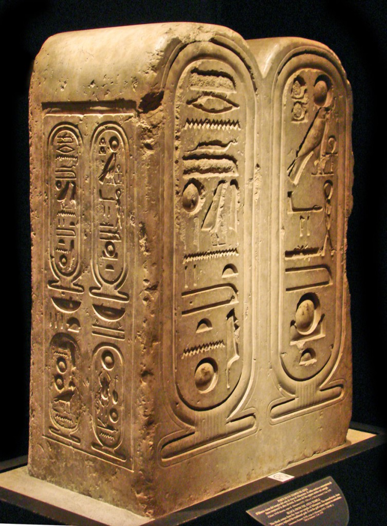
This is a well preserved stela from the Great temple of Aten from Akhetaten, Tall Al-Amarna, it bears the cartouche of Akhenaten, Neferkheperure, on its left side. The name of the god Aten is also shown enclosed in a royal cartouche. It is now in the Egyptian Museum of Turin. By dalbera (Jean-Pierre Dalbéra), Flickr and Wikimedia Commons.
Due to the size and history of the city it will not be discussed at any great lengths here, rather it would have its own page at a later point.
However, one of the highlights of the period and of Akhetaten and its discoveries is its art, and its departure of the strict idealistic formalism that was dominant in Egyptian art in favour of a more realistic depiction, with lots of murals depicting the royal family playing with their children. Although the worship of Aten (often referred to as the Amarna heresy) was completely suppressed, the artistic legacy had a more lasting impact. The art broke with a number of important long-established Egyptian conventions. These included intimate portrayals of affection within the royal family, and the abandonment of portraying women as lighter coloured than men. The art also has a realism that sometimes borders on caricature. Source.
Asyut
375km south of Cairo is Asyut; its name is derived from early Egyptian Zawty into Coptic Syowt. It was the capital of the 13th Nome of Upper Egypt, and the end of the road for Darb Al Arba’een trade route, or the 40 Day Road. It was once a flourishing trade post.
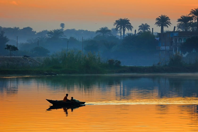
A fishing boat at dusk in Asyut. By Nour El Refai (Nour El Deen El Refai), Flickr. http://www.nourelrefai.com/.
There is little to see in Asyut, however, the little it has in way of Ancient Egyptian sites is important enough to be required reading for Egyptology students. There are several Coptic monasteries, the most significant of which are the Convent of the Virgin in Durunka, and Deir Al-Muharaqq (Burnt Monastery) 5km from Al-Qusiyah.
The barren hills en route to Durunka are riddled with the Tombs of the Nobles, mostly from the Middle Kingdom; they provide virtually the only record of events during the First Intermediate Period (2160 – 2050 BCE). The tomb of Djefaihapy I contains some of the oldest surviving legal documents anywhere. Source: The Rough Guide to Egypt.
Another site dating back to the 6th and 12th dynasties has been discovered west of Meir, in a low slope leading on to the desert plateau. The most important of these rock-cut tombs belong to the monarchs of the 14th Nome of Upper Egypt. At the moment only nine of the seventeen tombs are open to the public. The splendid desert hunting scenes in the tomb of Senbi-Sa-Ukh-Hotep, and the women’s fashions in Chancellor Ukh-Hotep’s tomb are the best of the lively illustrations in all of the nine tombs. Source: The Rough Guide to Egypt.
Wadi Al-Asyuty Protected Area
Announced in 1989, with a total area of 35km2, it is a captive and multipurpose area 400 km south of Cairo. It is mainly used to captivate and breed wild animals, like Egyptian deer, mountain goats, bighorn, ostrich, zebra and some reptiles. It is also used to collect and grow some plants that are threatened with extinction, as well as some medical and aromatic plants.
Sohaj
115km south of the city of Asyut is Sohaj; its history reaches back to the first 4 dynasties of Ancient Egypt, to the time of Narmer or Menes, the pharaoh credit with the unification of Ancient Egypt.
Even though Sohaj doesn’t share the glamour of its southern neighbour Luxor in terms of monuments, and it is overlooked by a lot of tour operators, it is no less in significance to Ancient Egyptian history or Egyptian culture in general. Just 12km to the northwest of the city of Sohaj are the White and Red Monasteries, both dating back to the 4th century CE and are open to visitors from 8am to 8pm.
Akhmim
Another reason to visit Sohaj is the city of Akhmim, known to the ancient Greeks as Khemmis, Chemmis and Panopolis, and as Ipu, Apu or Khent-min in Ancient Egypt.
According to 16th century Moorish geographer/historian Leo Africanus, Akhmim was the oldest city in Egypt. It is famed for its unique woven carpets and textiles, the weavers of Akhmim have been making handmade clothes and shrouds since the time of the pharaohs.
Abydos and the Cult of Osiris
Like Mecca to the Muslims, Abydos was the single most important place for ancient Egyptians; it was the centre of the Cult of Osiris. Located in the town of Al-Balyana, it held a monopoly on death cults because of its affiliation with Osiris, a monopoly that persisted into Ptolemaic times.
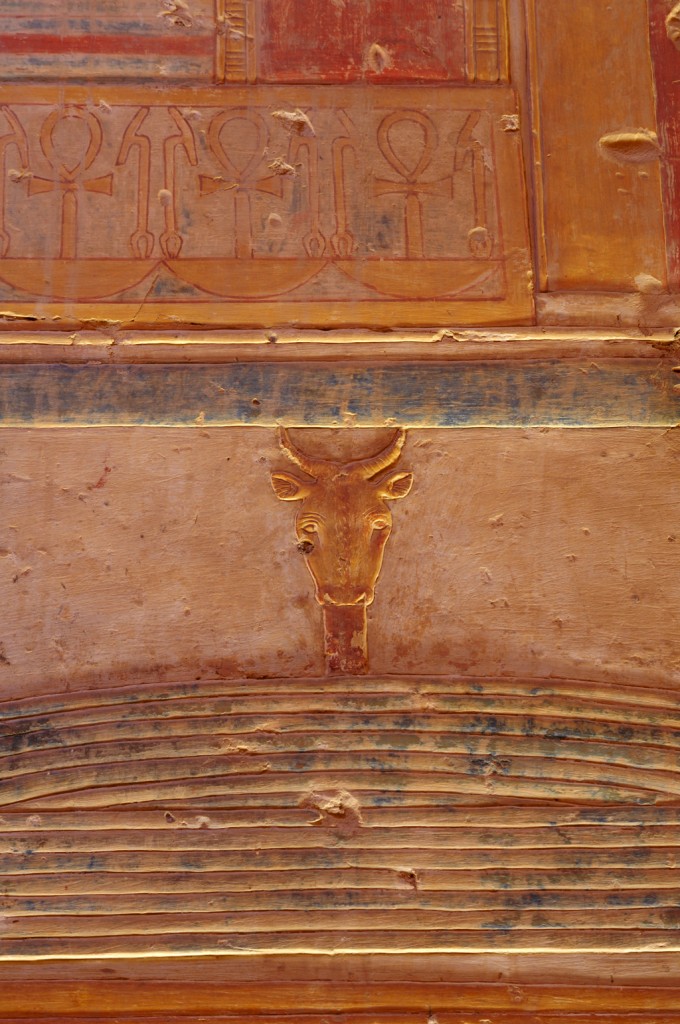
The first marvel you will see in Abydos is the Great Temple of Seti I considered to be one of Egypt’s most beautiful temples due to the quality of its bas-reliefs. It was finished by his son Ramses II. Directly behind it is The Osireion, a cenotaph to Osiris, an integral part of Seti I’s funeral complex and is built to resemble an 18th Dynasty Valley of the Kings tomb. Source.




Trackbacks for this post